Viz World
Viz World is the industry-standard tool for creating branded, high-quality 3D maps and geographic animations. Tell clearer stories and give your audience context by visualizing locations, data, and events on a global, national, and local scale with stunning accuracy.
Tell Clearer, More
Compelling Stories
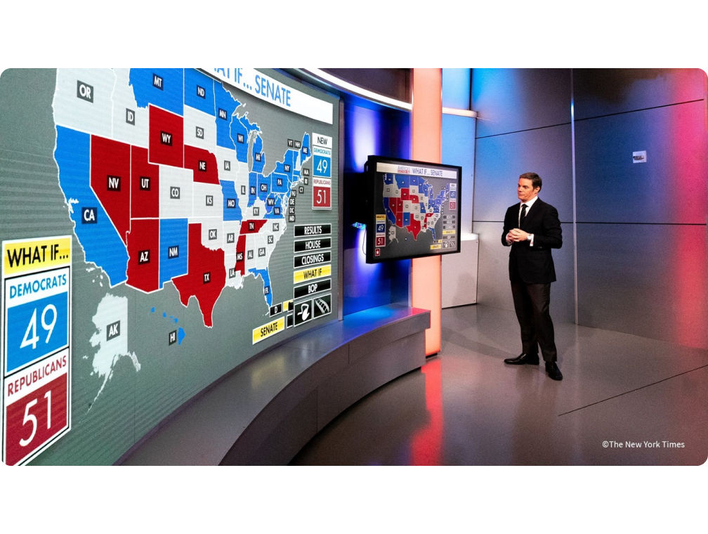
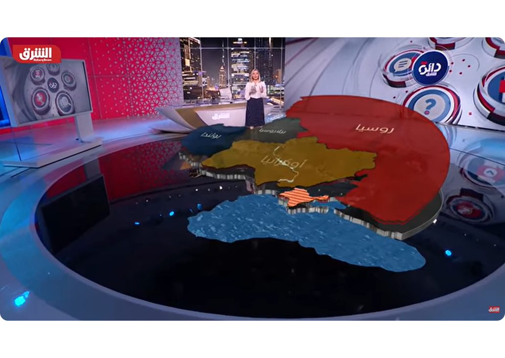
Turn abstract locations and data into clear, visual stories. Help your audience instantly grasp where and why events are happening, from breaking news and election results to weather patterns, making your content more memorable and impactful.
Ready for Tomorrow’s Production Needs, Today
Create Visually Stunning 3D Maps
Leverage high-resolution satellite imagery, topographic data, and street-level details to build incredible 3D maps. Customize every visual element to ensure your brand stands out with clarity and style.
eBook: Gen Z and the Decline of Traditional News Consumption
Discover how to captivate Gen Z with your news content! Download our free eBook, “Future Newsrooms: Creating Engaging News Content for Gen Z,” and unlock strategies to transform your newsroom for the next generation.
Viz World 24
Viz World 24 empowers broadcasters to create professional and engaging satellite maps like never before. By leveraging Maxar’s new MGP Pro satellite service, you can access high-resolution global base map imagery at 30cm HD, ensuring your maps are both visually stunning and accurate.
Common Questions & Answers
Find out all the essential details about our platform and how it can serve your needs.
Viz World is the industry-standard map creation software for broadcasters. It’s designed to produce high-quality, branded 2D and 3D maps and geographic animations that provide essential visual context for news, sports, and weather storytelling.
Where Creative Vision Meets
Production Power
Related Resources

The Future of Sports Streaming is Immersive Experiences
The power of channel branding and cross-promotion in 2024 and beyond: why it matters more than ever
Estimated reading time: 6 minutes In today’s media landscape, where viewers have access to an overwhelming number of channels and platforms, capturing and retaining audience attention is becoming increasingly challenging. With the rise of content consumption habits like “zapping” to other content during ad breaks – or changing to a different device altogether – broadcasters…